
Map and Directions
Argos, Argolis, Peloponnesos, Greece
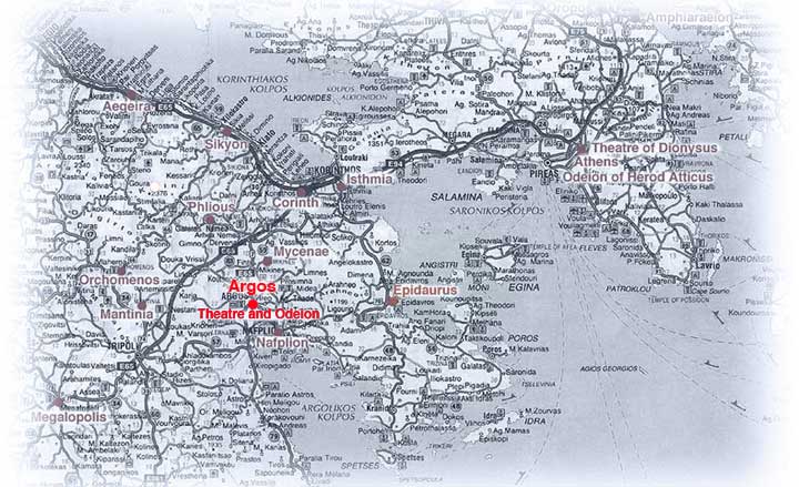
137km (85 miles) from Athens - 48 km (30 miles) South of Corinth
- By Car: From Athens, take the National Road to Corinth, and then follow signs for Argos and Tripolis. The road divides just after the sign for Ancient Corinth. The speedy new Corinth-Tripolis toll road has green signposts with drawings of highways. Take the Argos exit and follow the exit road until it reaches an obvious main road (the old Corinth-Argos road). Turn right, cross the bridge, and you'll soon enter Argos. If you take the old road to Argos, it runs straight into the town. It's never easy to park in Argos, but you'll probably find a place on one of the side streets off the central square or by the ancient theater.
- By Bus: Five buses a day run to Argos from the Stathmos Leoforia Peloponnisou (bus station for the Peloponnese) in Athens, 100 Kifissou (tel. 210/512-9233 or 210/512-4911). The bus ride usually takes just under 3 hours. Argos is also served by frequent buses from Nafplion (about 30 min.)
- from: Frommer's Greece, 4th Edition
- Copyright © 2006 Thomas G. Hines, Department of Theatre, Whitman College. All Rights Reserved.
- Last Update: 6/20/06